3.3. Committing Feature Modifications Over WFS-T
Until GeoExt also provides writers, we have to rely on OpenLayers for writing modifications back to the WFS. This is not a big problem though, because WFS-T support in OpenLayers is solid. But it requires us to take some extra care of feature states.
3.3.1. Managing Feature States
For keeping track of “create”, “update” and “delete” operations, OpenLayers
vector features have a state property. The WFS protocol relies on this
property to determine which features to commit using an “Insert”, “Update” or
“Delete” transaction. So we need to make sure that the state property gets
set properly:
OpenLayers.State.INSERTfor features that were just created. We do not need to do anything here, because the DrawFeature control handles this for us.OpenLayers.State.UPDATEfor features with modified attributes, except for features that haveOpenLayers.State.INSERTset already. For modified geometries, the ModifyFeature control handles this.OpenLayers.State.DELETEfor features that the user wants to delete, except for features that haveOpenLayers.State.INSERTset, which can be removed.
Tasks
Open
map.htmlin your text editor. Find the “Delete” button’s handler and change it so it properly sets the DELETE feature state and re-adds features to the layer so the server knows we want to delete them:handler: function() { app.featureGrid.store.featureFilter = new OpenLayers.Filter({ evaluate: function(feature) { return feature.state != OpenLayers.State.DELETE; } }); app.featureGrid.getSelectionModel().each(function(rec) { var feature = rec.getFeature(); modifyControl.unselectFeature(feature); vectorLayer.removeFeatures([feature]); if (feature.state != OpenLayers.State.INSERT) { feature.state = OpenLayers.State.DELETE; vectorLayer.addFeatures([feature]); } }); }
3.3.1.1. Understanding the Code
By setting the featureFilter on the store we prevent the feature from being
re-added to the store. In OpenLayers, features with DELETE state won’t be
rendered, but in Ext JS, if we do not want a deleted feature to show up in the
grid, we have to make sure that it is not in the store.
Also note that after removing the deleted feature from the vectorLayer,
we add it again unless it has an INSERT state (but it won’t show up because
of OpenLayers state handling and the featureFilter). This is necessary
because the transaction when saving changes needs to submit information about
deleted features, so they can be deleted on the server.
3.3.2. Adding a Save Button
Saving feature modifications the OpenLayers way usually requires the vector
layer to be configured with an OpenLayers.Strategy.Save.
But since we have a GeoExt store (and not an OpenLayers layer) configured with
the WFS protocol here, we cannot do that. Instead, we can call the protocol’s
commit() method directly to save changes.
Tasks
Find the definition of the grid toolbar’s Delete and Create buttons in your
map.htmlfile and add the “Save” button configuration and handler. When done, the whole buttons definition should look like this:bbar.add([{ text: "Delete", handler: function() { app.featureGrid.store.featureFilter = new OpenLayers.Filter({ evaluate: function(feature) { return feature.state != OpenLayers.State.DELETE; } }); app.featureGrid.getSelectionModel().each(function(rec) { var feature = rec.getFeature(); modifyControl.unselectFeature(feature); vectorLayer.removeFeatures([feature]); if (feature.state != OpenLayers.State.INSERT) { feature.state = OpenLayers.State.DELETE; vectorLayer.addFeatures([feature]); } }); } }, new GeoExt.Action({ control: drawControl, text: "Create", enableToggle: true }), { text: "Save", handler: function() { app.featureGrid.store.proxy.protocol.commit( vectorLayer.features, { callback: function() { var layers = app.mapPanel.map.layers; for (var i=layers.length-1; i>=0; --i) { layers[i].redraw(true); } app.featureGrid.store.reload(); } }); } }]);
Save your file and reload http://localhost:8080/ol_workshop/map.html. Make some changes and hit “Save”. Reload the page to see that your changes were persisted.
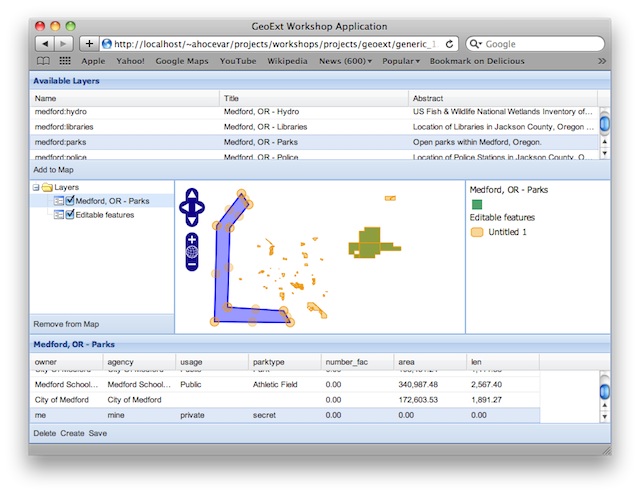
Application with “Save” button and a persisted feature after reloading.
3.3.2.1. The Commit Callback Explained
By calling the commit() method with a callback option, we can perform
actions when the commit operation has completed. In this case, we want to
redraw all layers to reflect the changes in WMS and group layers. And we also
reload the feature store, to reset all feature states and have all features
with their correct feature ids.
callback: function() {
    for (var i=layers.length-1; i>=0; --i) {
        layers[i].redraw(true);
    }
    app.featureGrid.store.reload();
}
Note that reloading the store is only necessary for GeoServer layers that use a shapefile as data store, because the WFS Insert doesn’t report the inserted feature ids for those.
3.3.3. Conclusion
You have successfully created a WFS based feature editor. GeoExt makes working with features easy, thanks to its FeatureStore. Although there is no write support yet for the FeatureStore in GeoExt, saving changes via WFS-T is easy because of the solid WFS-T support in OpenLayers and the interoperability between GeoExt and OpenLayers.